Products/Aetos Canvas

Powering GEOINT with
Advanced Data Visualization

Geospatial data visualization to the forefront, designed specifically for professionals who need to interpret complex geospatial data efficiently and effectively.
The Problem
Making sense of complex geospatial data is challenging, especially when data comes from multiple sources and requires actionable insights. Traditional tools often lack flexibility, real-time capabilities, or scalability to handle mission-critical scenarios.
The Solution
A highly customizable platform is needed to adapt to unique operational needs, allowing users to visualize their geospatial data in ways that align with mission-critical objectives and make actionable insights readily accessible.

Dynamic Geospatial
Visualization and Intelligence

E
n
t
e
r
p
r
i
s
e
 
-
 
R
e
a
d
y
 
P
r
o
d
u
c
t
s
 
t
h
a
t
Scale with Your Operations
Scroll to explore

Secure, Scalable,
and Modern Cloud Solutions

Optimized for resilience, scalability, and high availability, Aetosky ensures operations are supported on trusted and compliant systems.
creodias
azure
aws
gg-cloud
Hybrid Cloud Deployment:
Combine private cloud for handling sensitive workloads with public cloud scalability for non-sensitive operations.
Scalable Performance:
Elastic cloud architectures to dynamically allocate resources based on operational demands.

Powered by Aetos Core

Autoscaling & Resource Management
Seamless autoscaling and dynamic resource allocation, ensuring high performance even with large-scale geospatial models.
Continuous Delivery
Uninterrupted operations, ensuring smooth AI model deployment and real-time analysis without downtime.
Advanced Governance
Gain complete control over AI workflows with Aetos Core’s robust governance features, including detailed reporting and secure oversight.
Multi-Cloud Flexibility
Whether operating in public, private, or hybrid cloud environments, Aetos Core ensures seamless deployment and integration, providing the flexibility needed for mission-critical operations.

Empowering Data-Driven Decision-
Making Across Industries

01

Defense and Intelligence

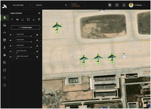
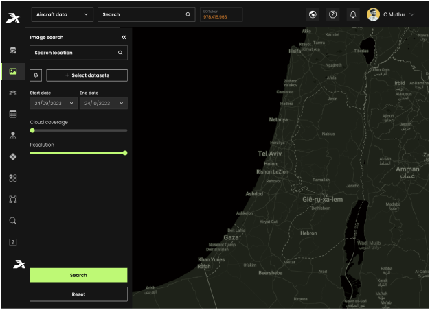
Transforms geospatial data into actionable insights for mission-critical operations. Enhances situational awareness, operational planning, and real-time threat detection.

Mission Planning
Change Detection
Target Analysis
Threat Monitoring
Alert Systems
02

Civil Governments

Streamlines urban governance by providing centralized insights for disaster management, sustainable planning, and infrastructure optimization.

Illegal Construction
Disaster Response
Vegetation Health Assessments
Flood Risk Mapping
Infrastructure Management
03

Mining Operations

Supports resource exploration and safety compliance through advanced geospatial insights, ensuring efficiency and environmental stewardship.

Site Exploration
Environmental Impact Assessments
Slope Stability Monitoring
Rehabilitation and Restoration
Discover how Aetosky can
modernize your GEOINT
operations
Request Demo