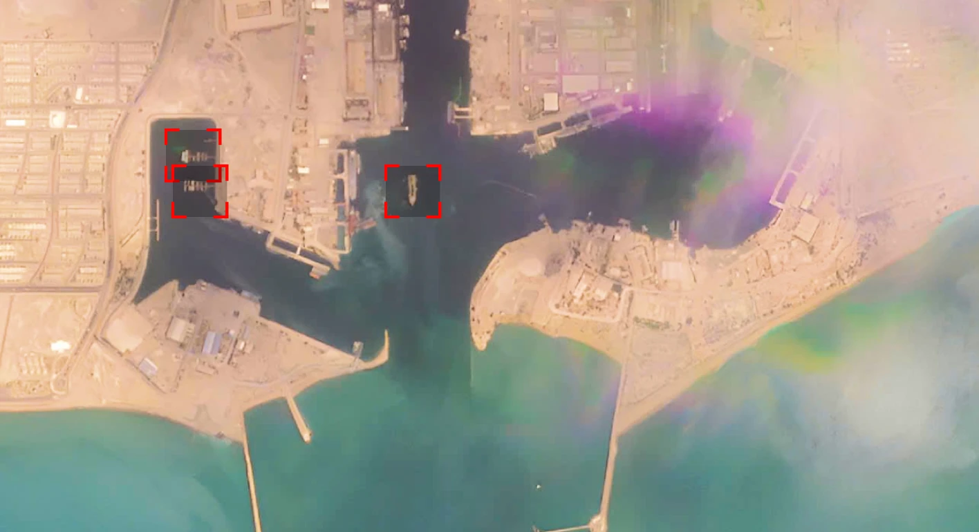
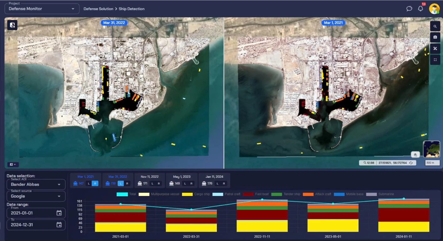
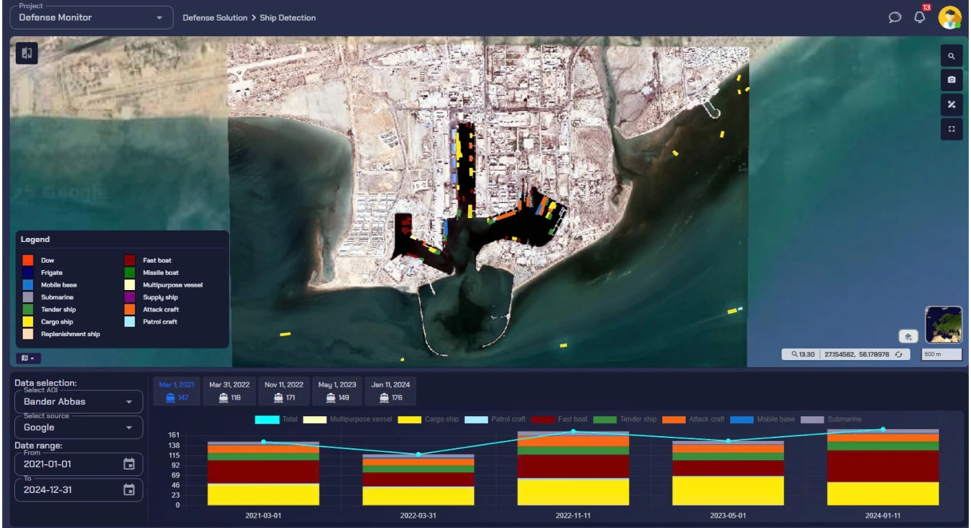
Harness the power of AI-driven automation to extract actionable intelligence from satellite imagery. Detect ships, planes, buildings, trees, vehicles, and more—seamlessly integrated into your workflows.
Analyzing satellite imagery manually is time-consuming and prone to errors. Aetosky’s automated object identification technology eliminates these challenges by:
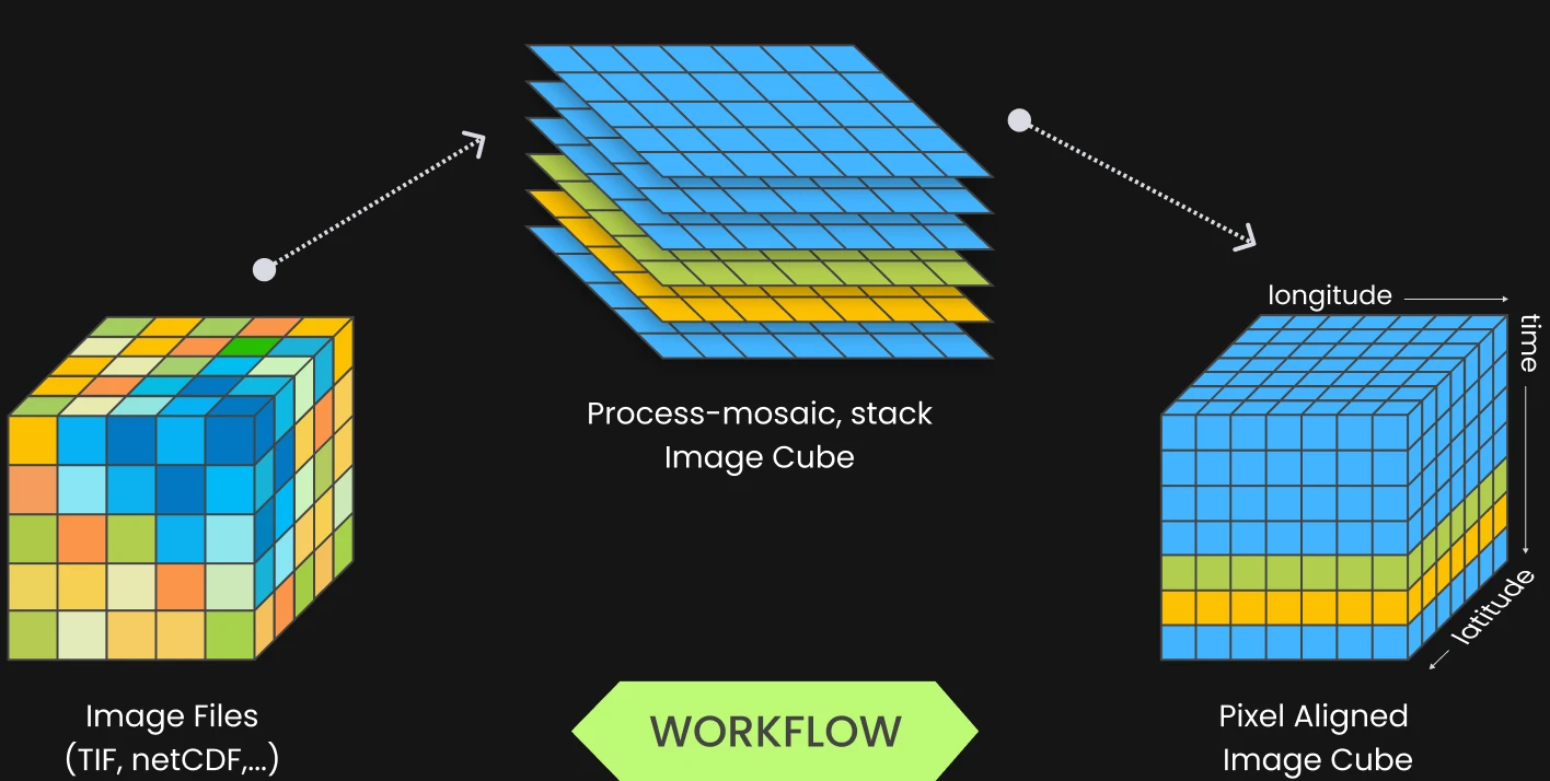
Auto Ingestion & Processing
Direct integration with satellite data providers ensures imagery is ingested, processed, and analyzed without manual intervention.
Reducing Human Workload
Automated workflows deliver insights instantly, enabling teams to focus on decision-making.
Ensuring Precision & Consistency
AI models eliminate bias and maintain accuracy across vast Areas of Interest (AOIs).
We use cookies to improve your experience, analyze site performance, and personalize content and ads. You can accept all cookies or customize your preferences to control which cookies are used.
We use cookies categorized as follows. You can enable or disable these based on your preference. Please note that disabling some cookies may impact site functionality.